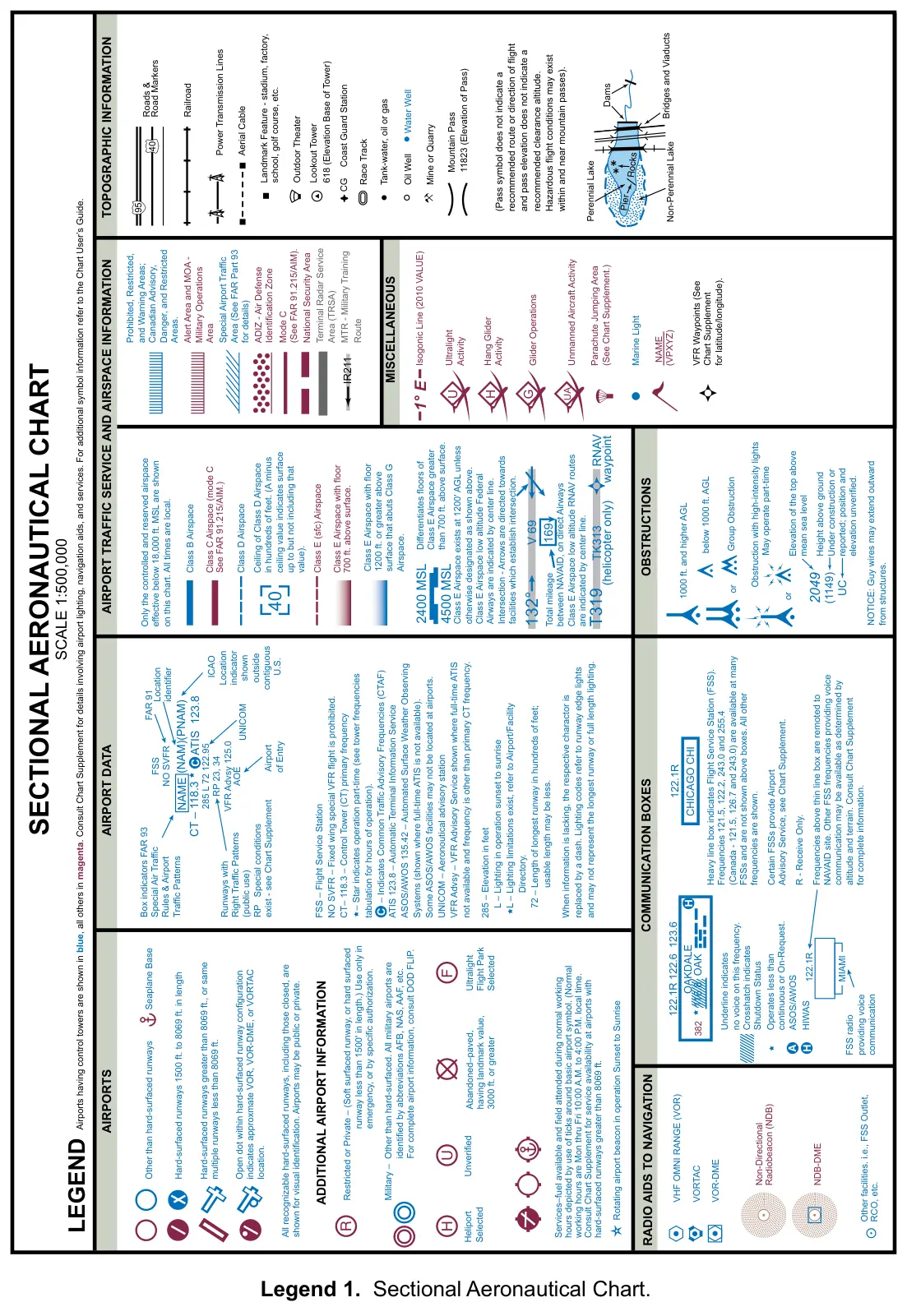
Legend 1: Sectional Aeronautical Chart
Practice
Sign in to practice with this figureText in this figure
LEGEND SECTIONAL AERONAUTICAL CHART SCALE 1:500,000 Airports having control towers are shown in blue, all others in magenta. Consult Chart Supplement for details involving airport lighting, navigation aids, and services. For additional symbol information refer to the Chart User’s Guide. Only the controlled and reserved airspace effective below 18,000 ft. MSL are shown on this chart. All times are local. Class B Airspace Roads & Road Markers Railroad Power Transmission Lines Aerial Cable Coast Guard Station CG Race Track Tank-water, oil or gas Oil Well Water Well Mine or Quarry Mountain Pass 11823 (Elevation of Pass) Landmark Feature - stadium, factory, school, golf course, etc. Outdoor Theater Lookout Tower 618 (Elevation Base of Tower) Ultralight Activity Isogonic Line (2010 VALUE) Marine Light Hang Glider Activity Glider Operations Parachute Jumping Area (See Chart Supplement.) VFR Waypoints (See Chart Supplement for latitude/longitude). Class D Airspace Class E (sfc) Airspace 2400 MSL 4500 MSL Class E Airspace with floor 700 ft. above surface. Class E Airspace with floor 1200 ft. or greater above surface that abuts Class G Airspace. Differentiates floors of Class E Airspace greater than 700 ft. above surface. Class E Airspace exists at 1200' AGL unless otherwise designated as shown above. Class E Airspace low altitude Federal Airways are indicated by center line. Intersection - Arrows are directed towards facilities which establish intersection. Ceiling of Class D…